
Survey Platforms
Measurements of coastal cliffs and evolving beach sand levels between the back beach and ~10 m water depth are obtained with GPS, LiDAR, and photogrammetry equipped survey platforms including a jetski, hand-pushed dolly, an all terrain vehicle, 4-wheel drive truck, and drones.
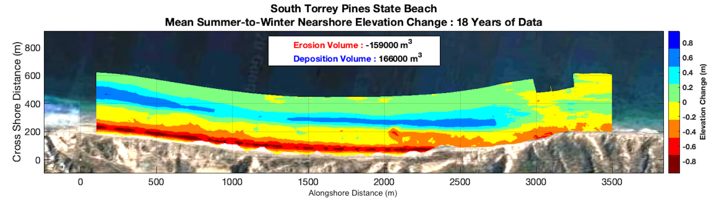
Observations collected over 18 years at Torrey Pines State Beach show spatial patterns of seasonal changes in sand level. Vertical change of almost 1 m (red) reduce the winter beach width. Over this 3 km alongshore reach, on average ~ 160,000 cubic meters of sand is exchanged seasonally between the eroded beach face (red) and an offshore sand bar (blue).
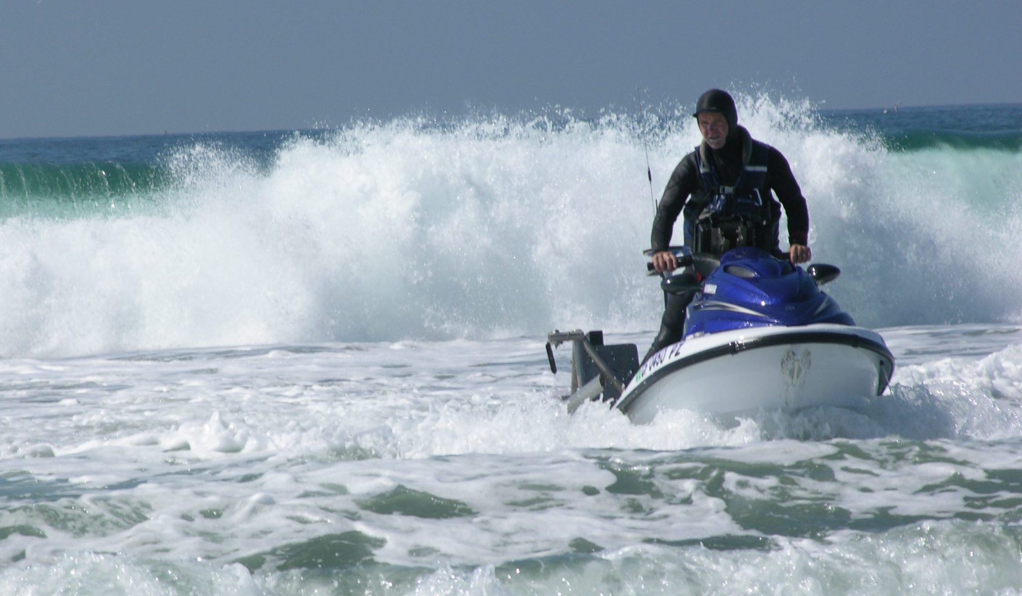
Survey Jetski
Operates close to shore where agility in waves is required. Surveys bathymetry between ~1 - 10 m water depth using a sonic depth finder and can sample (while underway) conductivity, temperature, dye concentration, and turbidity.
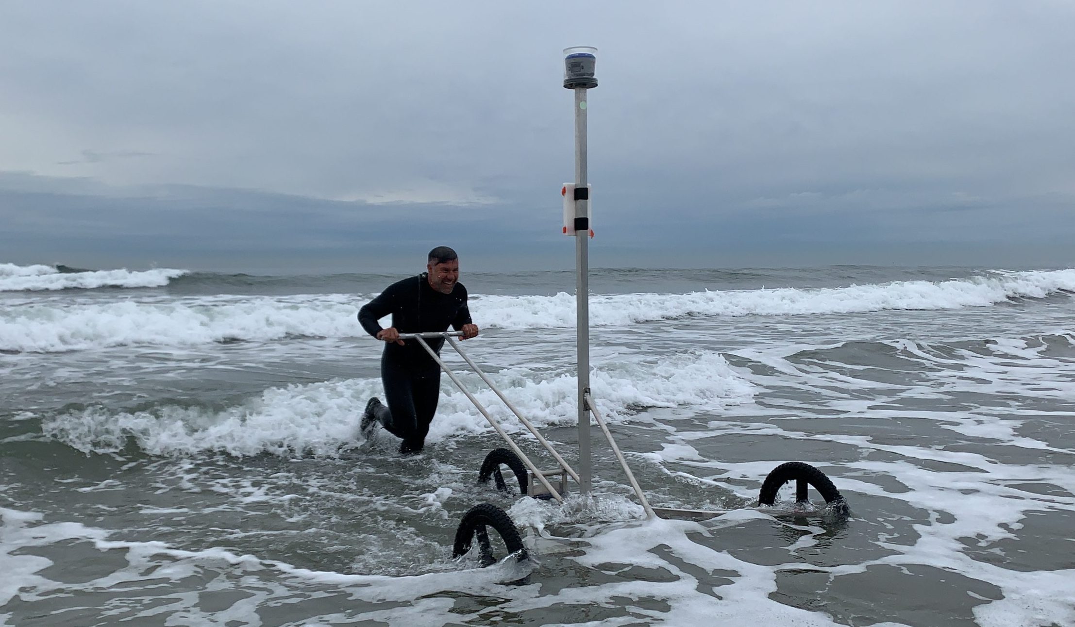
Survey Dolly
Operates in the surfzone, too deep for the all-terrain-vehicle and too shallow for the jetski.
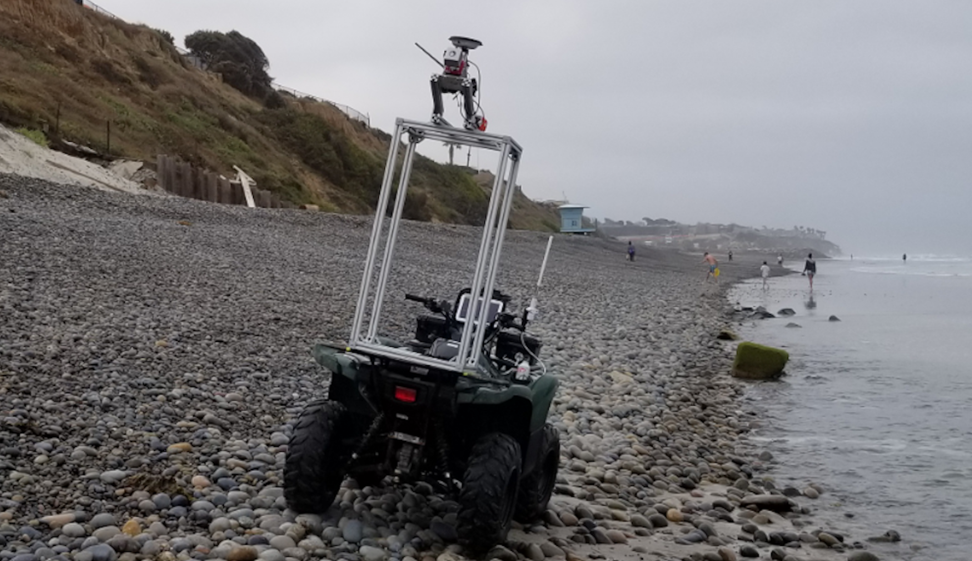
Survey All Terrain Vehicle (ATV)
Surveys beach elevation above the waterline and can be equipped for cobble mapping.
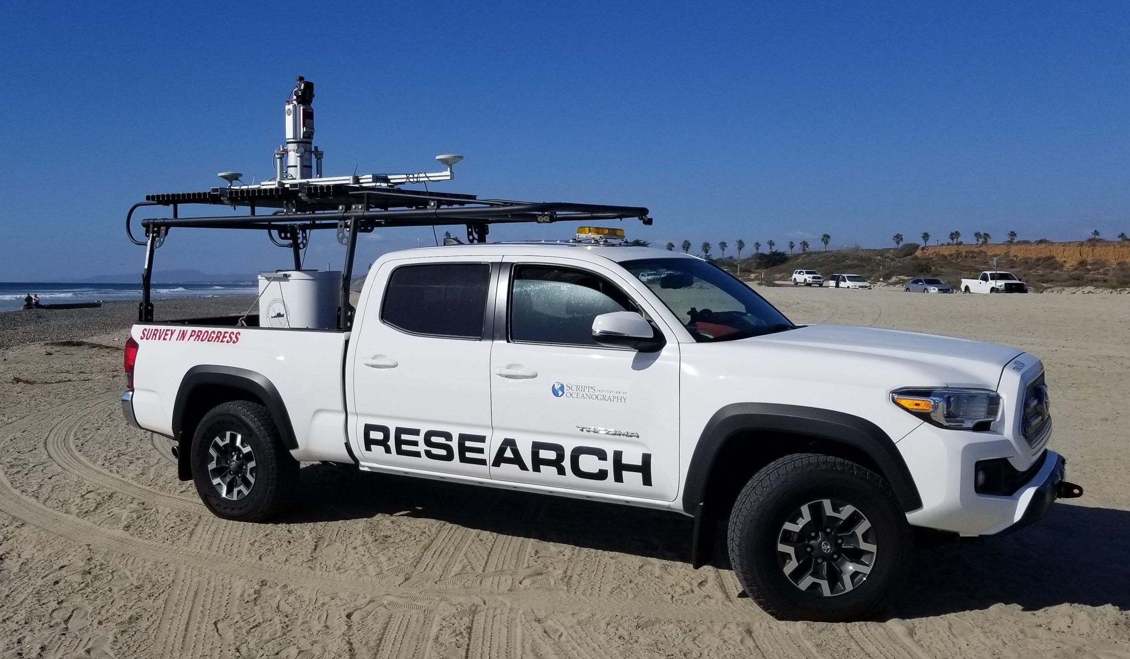
Survey Truck
Carries a scanning LiDAR that surveys beaches and cliffs with high accuracy and resolution.
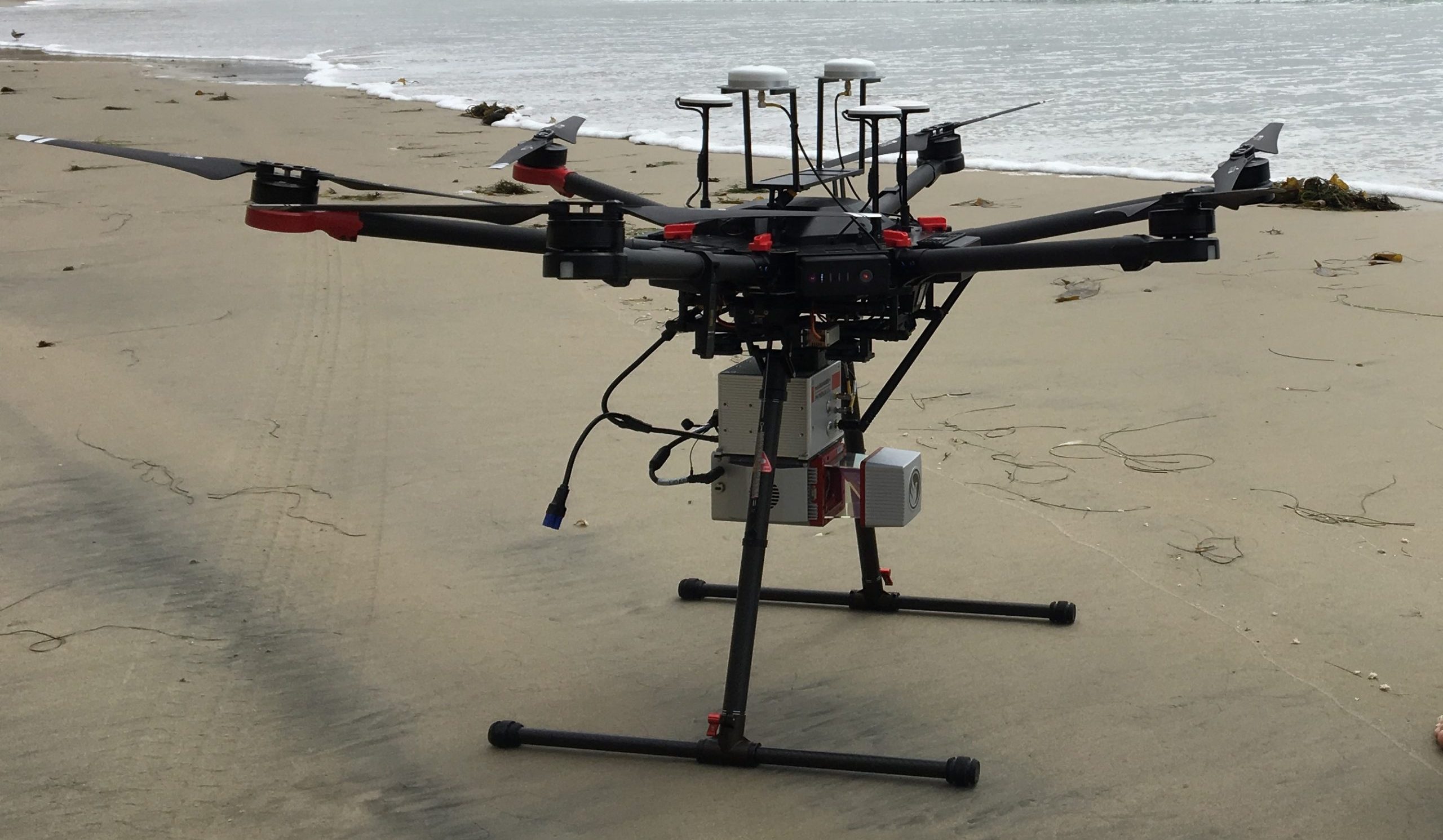
Drone
Provides a platform for cameras, video cameras, and a scanning Lidar to obtain high-resolution sub-aerial (exposed beach) sand level and cliff surveys. Surveys are conducted by a fixed wing airplane pilot or FAA Part 107 drone pilot.