
The Mysterious Beach Cobbles
Beaches are always changing, dynamic, coastal landforms. These changes can threaten human lives and coastal properties, and also effect beach usage. Better understanding of beach changes and their relationships with ocean forces (waves, tides, currents, etc.) is critical given anticipated future climate change and increased storminess.
Relatively large grain size sediments (64-254 mm in diameter), called cobbles, occur plentifully but also often intermittently on southern California beaches. They move continuously along with beach sand, generally surfacing in winter, and buried in summer. However, patterns vary year to year. Cobbles influence beach shapes and wave actions on beaches, but how and how much they modify the beach and beach processes are still unknown. Overall, we still know very little about “mysterious” beach cobbles. The goal of this research is to better understand the behaviors and roles of cobbles in beach evolution. The effect of sea level rise and changes in waves on the prevalence of surface cobbles is unknown.
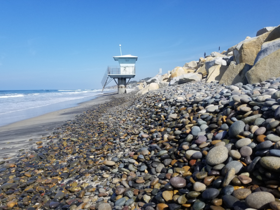
Figure 1: Cobbles piling up on the back beach.

Figure 2: Cobbles are measured with a truck-mounted LiDAR
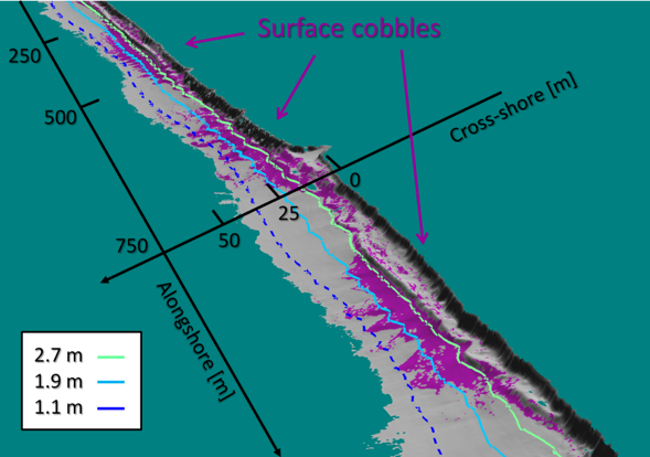
The primary observing tool is Light Detection and Ranging (LiDAR). The truck-mounted LiDAR system (Figure 2) has been used to generate high-resolution three-dimensional (3D) surface elevation maps for San Diego county beaches. Survey frequency has varied from daily to seasonally. A newly-developed machine learning technique that locates surface cobbles (Figure 3) is applied to LiDAR 3D digital maps (Figure 4). Observations of surface cobbles and beach topography at high temporal and spatial resolutions using LiDAR is continuing. A project to track dozens of individual cobbles is underway.
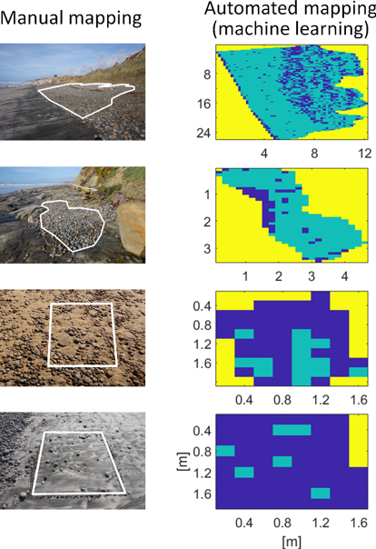
Figure 3: Manual versus automated surface cobble mapping using machine learning. Green, blue, and yellow in the automated results indicate areas of cobble, non-cobble, and no-data, respectively.
Publications
Matsumoto, H., Young, A.P., Guza, R.T. (2020), Cusps and mega cusps on a mixed sediment beach, Earth and Space Science. DOI:10.1029/2020EA001366.
Matsumoto, H., A. P. Young, R. T. Guza (2020), Observations of surface cobbles at two southern California beaches, Marine Geology, Volume 419, 106049, ISSN 0025-3227, https://doi.org/10.1016/j.margeo.2019.106049.
Matsumoto, H. and A. P. Young (2018) Automated Cobble Mapping of a Mixed Sand-Cobble Beach Using a Mobile LiDAR System. Remote Sens.10, 1253.