
California Coastal Change Database
Effective future management of California coastal parks requires understanding past and ongoing shoreline change. The Coastal Processes Group at Scripps Institution of Oceanography (SIO) has assessed the general availability of historical airborne LiDAR for park shoreline change analysis. The NOAA Digital Coast archive currently contains 47 airborne LiDAR surveys (1997-2020) that include some part of the California open coastline (Figure 1). Many of these surveys fall within coastal State Park boundaries (Tables 1-14). In most cases, these surveys of beach sand levels and cliff morphology have not been examined specifically for Parks. An online viewing tool is being developed to integrate the Park LiDAR data with the SIO nearshore wave hindcast database for the California coast. A demonstration of the online viewer (eg. Figure 2) is now available for five California State Parks spanning the State. The viewer will be expanded to included more Parks, based on Park management priorities, and new LiDAR data will be added to the database as it becomes available.
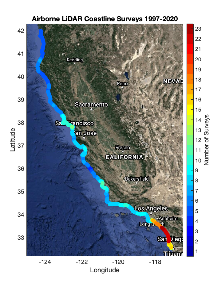
Figure 1. Historical airborne LiDAR survey coverage schematic. San Diego and Orange County coasts have the most surveys (20+ red) owing to a decade-long (2000-2010) airborne beach change study lead by Scripps. The San Francisco Bay Area has 10+ surveys (orange), while northern California has less than 5 (blue).
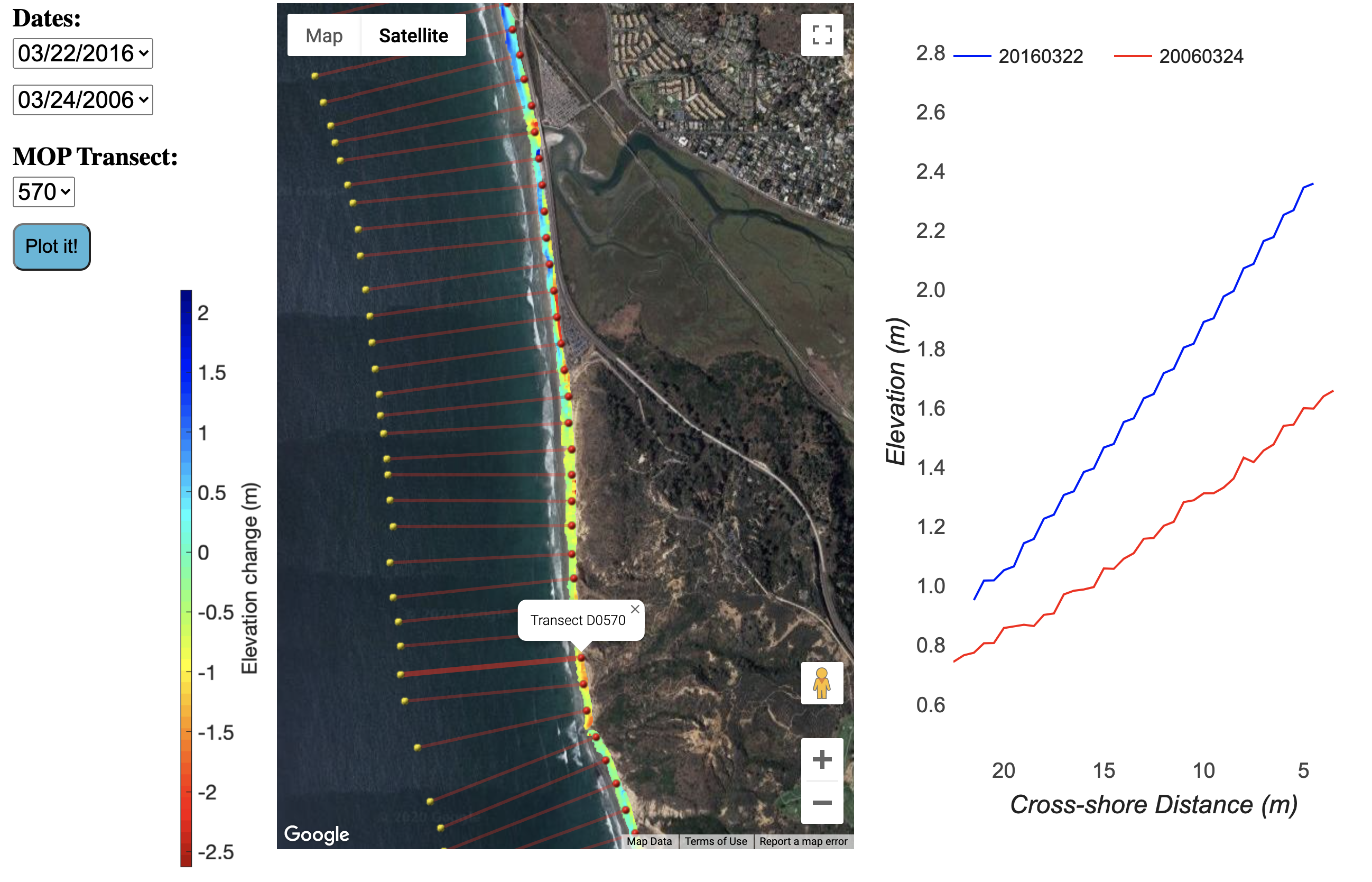
Figure 2: Coastal change between March 24, 2006 and March 22, 2016 at Torrey Pines State Beach. (left) Aerial view with colors indicating sand level change (see scale. Some alongshore locations accreted, whereas others eroded. Red cross-shore transects are SIO wave and beach Monitoring and Prediction (MOP) lines (O’Reilly et al, 2016). (right) elevation versus cross-shore distance on MOP D0570. There are (user selectable) 26 Lidar surveys and ~70 MOP Lines.