
Flood Forecast
Please note: The following flood forecast is experimental and still in the process of being tweaked and refined.
Click to enlarge
 Warning: This product is experimental and should not be used for planning purposes.
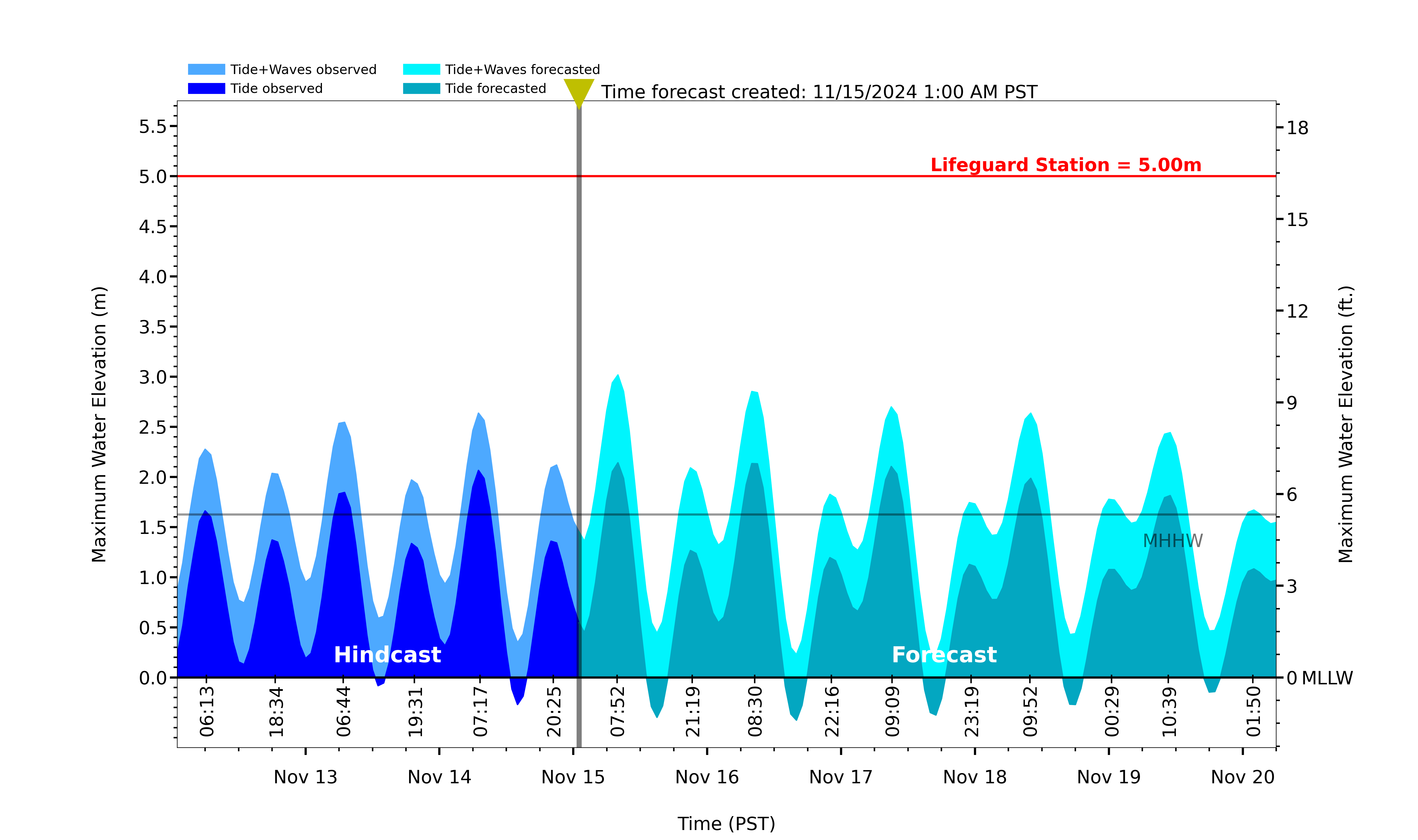
Wave runup predictions at this site are made with LiDAR-derived foreshore beach slope extending from MSL to MHW at MOP transect L0899.
Offshore wave conditions are extracted from the CDIP Topanga Nearshore Buoy (103) in 20m (67 ft) water depth. Forecasted waves include mean setup and time-variable swash motions, predicted by the Integrated Power law Approximation (IPA) described in this paper. The equation is tuned for MOP transect L0899, with optimal parameter values:
The flood threshold (red line) is taken to be the vertical measurement (MLLW datum) of the nearby lifeguard station. Observed waves for this plot are derived with the ‘nowcast’ CDIP wave products.