
Flood Forecast
Please note: The following flood forecast is experimental and still in the process of being tweaked and refined.
Click to enlarge
 Warning: This product is experimental and should not be used for planning purposes.
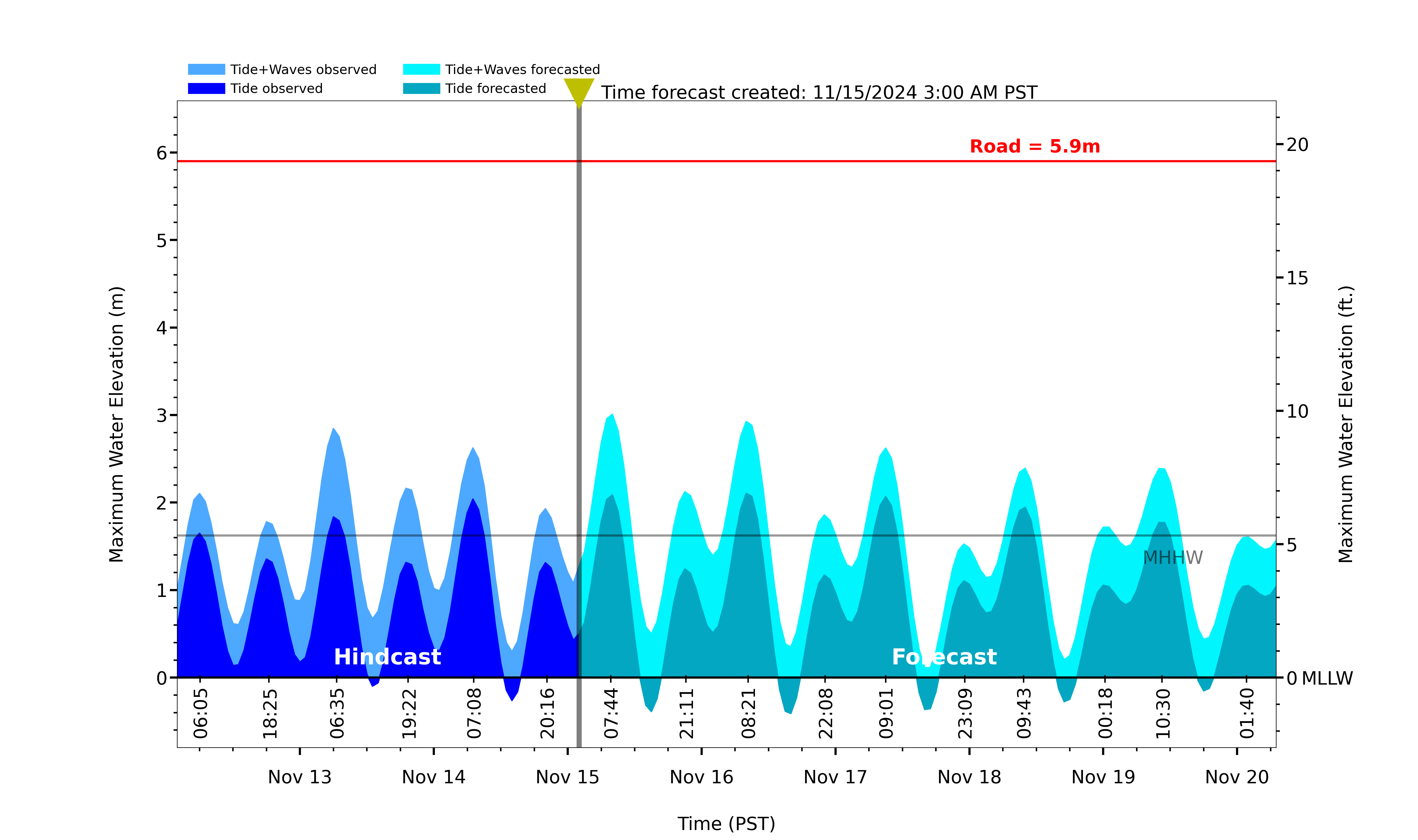
Wave runup predictions at this site are made with LiDAR-derived foreshore beach slope extending from MSL to MHW at MOP transect D0582.
Offshore wave conditions are extracted from the CDIP Torrey Pines Outer Buoy (100) in 572m water depth. Forecasted waves include mean setup and time-variable swash motions, following Stockdon et al. 2006, equation 19, averaged at three-hour forecast intervals.
The flood threshold (red line) is taken to be the vertical measurement (MLLW datum) of the parking lot entrance (road). Observed waves for this plot are derived with the ‘nowcast’ MOP wave products.